Multiple industries
Alternative protein
Aquaculture
Cereal grains
Cross industry
Essential oils
Fruits
Game
Honey bees
Nuts
Other rural industries
Pasture, fodder & feed
Poultry
Pulse grains
AgriFutures Australia
With the scale of broadacre farming in Australia, there is demonstrable need to develop a method to quantify soil organic carbon content at scale and at low cost. Remote sensing, originally used by the likes of NASA to predict country-level yields, presents the ability to drastically reduce the cost of soil organic carbon quantification by foregoing the two largest cost drivers of traditional sample coring and lab analysis: time to collect physical samples and lab analysis dependent on specialized equipment. This project is designed to demonstrate the capacity of remote hyperspectral remote sensing and advanced machine learning-based approaches to overcome prohibitively high costs of soil sampling, and will consist of aerial hyperspectral and ground sample data collection for the purposes of determining the accuracies of and correlation between measurements produced by the two approaches. By delivering high spatial resolution soil organic carbon measurements at scale, hyperspectral-driven remote carbon monitoring stands to enable Australian farmers to make significant progress towards regenerative and environmentally acceptable farming systems. Furthermore, this work is pivotal toward a large-scale understanding of the carbon captured by Australian soils, and as a foundation to one day enable these insights to be produced from data captured by satellite instrumentation.
-crop-850x675.png)
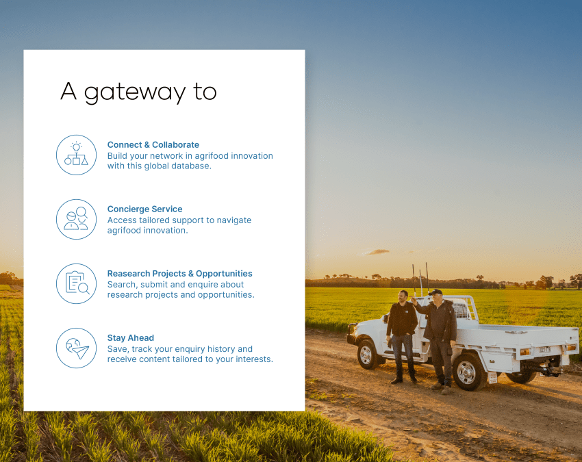
Have questions?
Find answers to our most frequently asked questions on research projects, commercial opportunities, organisations and more.
Still have questions or have feedback on the site? Please get in touch by completing our enquiry form.